Ocean City climate & storms

Barrier-island weather is more than a sunny beach icon. Use this page for season habits, storm-week realism, and the weather tools you actually open before you load the wagon.

We do not mirror live watches and warnings. Those change hour to hour. Start with today’s weather or beach weather, confirm National Weather Service products the morning you go, and treat rental cancellation policies as part of your budget.

Weather tools for this week

Climate tells you what Ocean City weeks usually feel like. These cards open the live tools for today, beach comfort, marine go/no-go, tides, radar, and rainy-day backups. Full map: Weather hub.
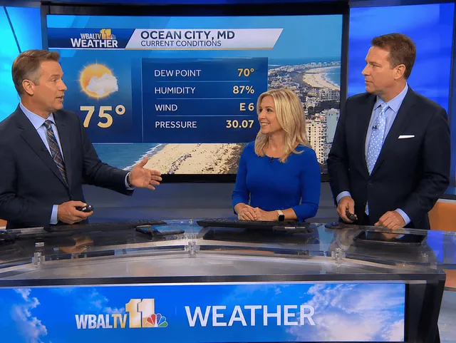
Today's Weather in Ocean City, Maryland

Today's Weather in Ocean City, Maryland

Current NWS forecast, live radar, and temperature for today.

Ocean City, Maryland 10-Day Forecast

Ocean City, Maryland 10-Day Forecast

Extended outlook — NWS detailed forecast plus 10-day model trends.

Beach Weather — Ocean City, Maryland

Beach Weather — Ocean City, Maryland

Surf, wind, radar, and sea temp for Ocean City beach days.

Compare Forecasts — Ocean City, Maryland

Compare Forecasts

NWS, Windy, and WillyWeather side by side—plus more Ocean City forecast links.

Weather overview — Ocean City, Maryland

Weather overview

Ocean City, Maryland Weather hub — all tools and related guides.

Weather maps & live tools — Ocean City, Maryland

Weather maps & live tools

Full overlay console (radar, wind, waves, tides, SST)—not the visitor Beach Weather page.

Inshore weather — Ocean City, Maryland

Inshore weather

Isle of Wight Bay, harbor chop, WillyWeather dock check.

Offshore weather — Ocean City, Maryland

Offshore weather

Swell, wind waves, and open-ocean conditions from Ocean City Inlet.

Cloud cover — Ocean City, Maryland

Cloud cover

ECMWF cloud overlay—sun, storms, and sky light.

Radar — Ocean City, Maryland

Radar

Live loops—summer pop-ups and storm training.

Sea temperature — Ocean City, Maryland

Sea temperature

SST breaks for offshore edges and inshore warm water.

Air temperature — Ocean City, Maryland

Air temperature

Heat, sea breeze, and winter comfort layers.

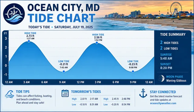
Tide charts & stations — Ocean City, Maryland

Tide charts & stations

Live TideGraph / NOAA clocks — pair with the Tide planning guide for prose.

Waves — Ocean City, Maryland

Waves

Height + period context for inlet and offshore.

Wind — Ocean City, Maryland

Wind

Direction, fetch, and sea breeze for OC waters.

Marine weather updates — Ocean City, Maryland

Marine weather updates

NOAA/buoy habits for boat days—not beach-day visitor forecasts.

Tide planning guide — Ocean City, Maryland

Tide planning guide

Editorial tide timing—pair with live Tide charts; not a substitute for NOAA clocks.

Rainy day ideas — Ocean City, Maryland

Rainy day ideas

Indoor pivots when cells scrub the beach plan.

Live webcams — Ocean City, Maryland

Live webcams

Visual check of Boardwalk/beach/inlet skies—not a forecast substitute.

Weather F.A.Q. — Ocean City, Maryland

Weather F.A.Q.

Seasons, storms, water temps — sourced Ocean City MD answers.

What Ocean City weather usually feels like

Ocean City sits on the open Atlantic side of the Delmarva Peninsula. Summers run warm and humid with frequent afternoon sea breezes. Rain chances stay in play even in “beach weather” weeks. Winters are cool and windy, with modest average snow and the occasional coastal ice event that still matters for bridges west of town.

Encyclopedic sources describe the climate as humid subtropical (Köppen Cfa) or near the oceanic boundary. For travelers: pack a light shell for restaurant AC and thunderstorm downdrafts, and do not equate calendar July with automatic dry skies. Physical context for why wind and surge behave this way lives on Geography of Ocean City.

Summer heat, humidity & beach pacing

  • Heat index can outrun the thermometer. Tropical air can push feels-like values above 100 °F even when the reading looks tolerable. Shade and water matter more on reflective sand than on a tree street in Berlin.
  • Sea breezes help, then humidity stacks. Boardwalk blocks often feel breezier than lots a few streets west. Comfort is still situational ahead of fronts.
  • Midday is the hard part. Early beach blocks and later Boardwalk nights usually feel better than a long noon sit. Kids and seniors feel the difference first.

Hurricane season overlap

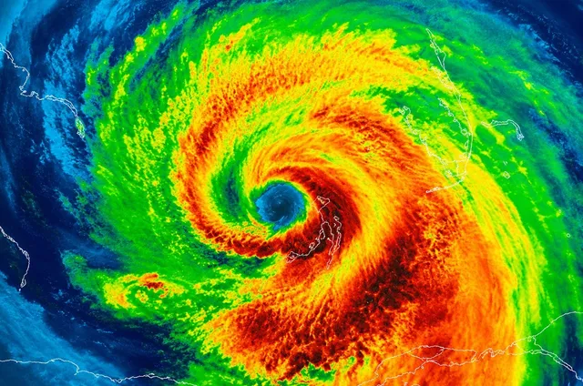
  • June 1 through November 30. The sharpest tropical activity historically runs late August into September, square inside peak family vacation windows.
  • Indirect hits are the common story. Swell, rip currents, coastal flooding, and two-day washouts happen more often than a named storm landing on Coastal Highway.
  • Flex days beat bravado. Refundable layers and alternate indoor plans matter more than a perfect itinerary screenshot.

Thunderstorms & storm-stack pivots

  • Lightning clears the beach fast. Arcades, restaurants, and museums absorb the crowd at once. Bookmark rainy day ideas before the first boom.
  • Boat and fishing days need a marine call. Small-craft advisories and zone forecasts come from NWS marine products. Captains still own go/no-go. Start with marine & fishing weather tools, not a sunny webcam alone.
  • Dinner fills when sand empties. Pivot early to takeout or an earlier reservation when cells stack mid-afternoon.

Nor’easters, winter & shoulder season

  • Nor’easters own October–April headlines. Prolonged onshore winds, tide stacking, dune overwash, and Boardwalk spray still rewrite plans when hurricane hashtags are quiet.
  • Winter averages look mild until they don’t. Highs often sit in the 40s °F with milder spells, but wind chill on an empty Boardwalk feels like a Great Lakes waterfront, not Orlando.
  • Storm history still shapes the map. Inlet and storm context lives on Ocean City history when you want the human timeline behind today’s beach.

Surf, swell & rip currents

  • Blue skies can still mean rough water. Distant storms send long-period swell without a local landfall. Pair Beach Weather tools with Beach Patrol flags.
  • Flags beat social media. Teach kids that posted flags and lifeguard calls decide the swim, not a sunny selfie. See the flags & rip currents F.A.Q.
  • Tides change the berm you get. Use the tides guide with live tide tools when planning dawn walks or vehicle beach windows.

Meteorology vs municipal messaging

NWS Wakefield (AKQ) owns the meteorology: watches, warnings, marine zones, and surf-zone products. The Town of Ocean City and Worcester County publish evacuation guidance, bridge detours, special event zones, and beach operational posts. Start from oceancitymd.gov when the question is “what is legally closed?”

Town tourism on OC Ocean and wide visitor scanning on OceanCity.com help you feel the week. They do not replace Wireless Emergency Alerts. Bookmark roles on Ocean City Info official portals.

Climate & storm FAQs

What kind of climate does Ocean City have?
Reference summaries usually place Ocean City in a humid subtropical (Köppen Cfa) or maritime-influenced border zone: long warm summers, cool winters, and rain chances year-round. The ocean often moderates highs compared with inland Mid-Atlantic cities on many July afternoons.
Why does the Boardwalk feel breezier than a parking lot a few blocks west?
Sea-breeze circulation is common on Delmarva summer afternoons: onshore flow picks up as land heats faster than water. That can cap extreme heat, but humidity can still stack ahead of fronts. Comfort is situational, not automatic.
When is hurricane season, and how does it overlap beach weeks?
The Atlantic hurricane season runs June 1 through November 30, with the sharpest tropical activity historically from late August into September, right in peak vacation windows. Flex days and refundable layers matter more here than at mountain cabins.
Are direct hurricane landfalls common in Ocean City?
Many tropical systems curve offshore north of the Carolinas, so a direct hit on any one Maryland beach town is uncommon compared with Florida or the Gulf. Uncommon is not impossible. Brush events, surge, and swell from distant storms still shape surf, rip currents, and evacuation psychology in busy weeks.
What is a nor’easter, and why does it matter if I only care about July?
Nor’easters are strong extratropical lows that track near the coast, typically strongest October through April. They drive coastal flooding, beach erosion, and multi-day onshore winds outside hurricane season. Shoulder-season visitors feel them more, but spring storms still rewrite dunes July crowds assume are permanent.
Where should visitors get watches, warnings, and evacuation orders?
National Weather Service products, Wireless Emergency Alerts on phones, and Worcester County / Town of Ocean City emergency channels, not travel blogs or social reposts. Marine forecasts and small-craft advisories come from NWS marine zones. This site never replaces those products.
Why do rip currents matter on blue-sky weeks?
Distant storms can send long-period swell to the Mid-Atlantic without a local landfall. Lifeguard flags, USLA guidance, and NWS surf zone forecasts exist because sandbars and currents change daily. Check the guarded beach’s posted system before you assume calm water from a sunny icon.
Do live beach webcams replace NWS warnings or Beach Patrol flags?
No. Webcams help you scan mood and crowds. They do not publish meteorological watches or legal beach closures. Stack NWS products with Town and Worcester emergency channels, then use Ocean City Info official portals when you are unsure which site owns which answer.
How should dining plans change when thunderstorms scrub the beach?
Pivot early. Kitchens fill fast when everyone flees the sand at once. Rainy-day indoor lists help, and takeout can spare another parking hunt when kids are already cranky.
Do thunderstorms cancel golf the same way they cancel beach time?
Often. Courses suspend for lightning and may close when turf is unsafe. Confirm with the pro shop or your booking app. Meal planning and drive bands still live on the golf hub; miniature golf on the family fun hub is a different rainy-day backup.

Beach Blog on Climate & storms

Trip reads written for this hub—pacing and advice, not a second directory.