Ocean City, Maryland — history
This page walks through Ocean City history, from a fishing spit to today's resort. Storms, bridges, and the boardwalk economy are covered, with links to museums and archives when you want primary sources.
The text below weaves together widely repeated dates and narratives found in encyclopedic summaries, the Greater Ocean City Chamber of Commerce, preservation blogs, and Maryland cultural institutions. It is meant for orientation and curiosity, not for boundary disputes, insurance claims, or academic citation without checking primary records yourself.
This page is the full Ocean City history timeline for visitors. For weather realism see Climate & storms — full guide; for museums see museums; for geography see geography of Ocean City.
For today’s Town services, ordinances, tourism campaigns, and regional business context layered on top of this past, use the four-portal bookmark map at Ocean City Info — official portals—deeds, incorporation papers, and engineering archives still live in libraries and .gov repositories, not blog comment threads.
Indigenous coasts and colonial land patents
Long before Atlantic hotels, Algonquian-speaking nations—including ancestors associated with the Nanticoke and Assateague—used Delmarva’s bays, marsh edges, and barrier spits for fishing, travel, and seasonal movement. English colonization later layered county grids and coastal patents onto those shorelines. Thomas Fenwick, an English landholder, figures in many popular summaries as an early titleholder for the tract that would become Ocean City’s developed spit. For tribal histories and treaties, defer to contemporary Indigenous nations and scholarly sources rather than resort marketing copy.
From “Ladies’ Resort to the Ocean” to a plotted town (1860s–1880)
By the late 1860s the barrier beach was already being nicknamed “The Ladies’ Resort to the Ocean”—a Victorian branding of sea air and respectability. In 1869, Baltimore businessman Isaac Coffin built what tour guides call the first oceanfront cottage explicitly aimed at paying guests, reached by stagecoach and ferry. Other boarding houses followed, drawing investors from the Eastern Shore, Baltimore, Philadelphia, and Wilmington to survey the sand spit as real estate.
Developers subdivided roughly 250 oceanfront lots and sold shares in a land company—popular accounts cite 4,000 shares at $25—to capitalize streets and services. The symbolic birth of Ocean City as a destination hotel town is July 4, 1875, when the Atlantic Hotel opened with ballroom and billiard rooms; the Purnell family’s long stewardship of a rebuilt Atlantic is part of living local memory. Incorporation as a town followed in 1880.
Railroads and the fish-traffic economy
Rail mattered as much as sunburn cream. By 1878, visitors could ride the Wicomico & Pocomoke Railroad from Berlin to the Sinepuxent Bay shore opposite town; by 1881 the Baltimore, Chesapeake & Atlantic Railroad completed a line across the bay so passengers stepped off trains directly onto the island while iced catches of local fish rode eastbound toward city markets. That two-way flow—tourists in, seafood out—helped knit Ocean City into the Chesapeake economy decades before the Bay Bridge made weekenders ubiquitous.
Life-Saving Service and the modern Coast Guard story
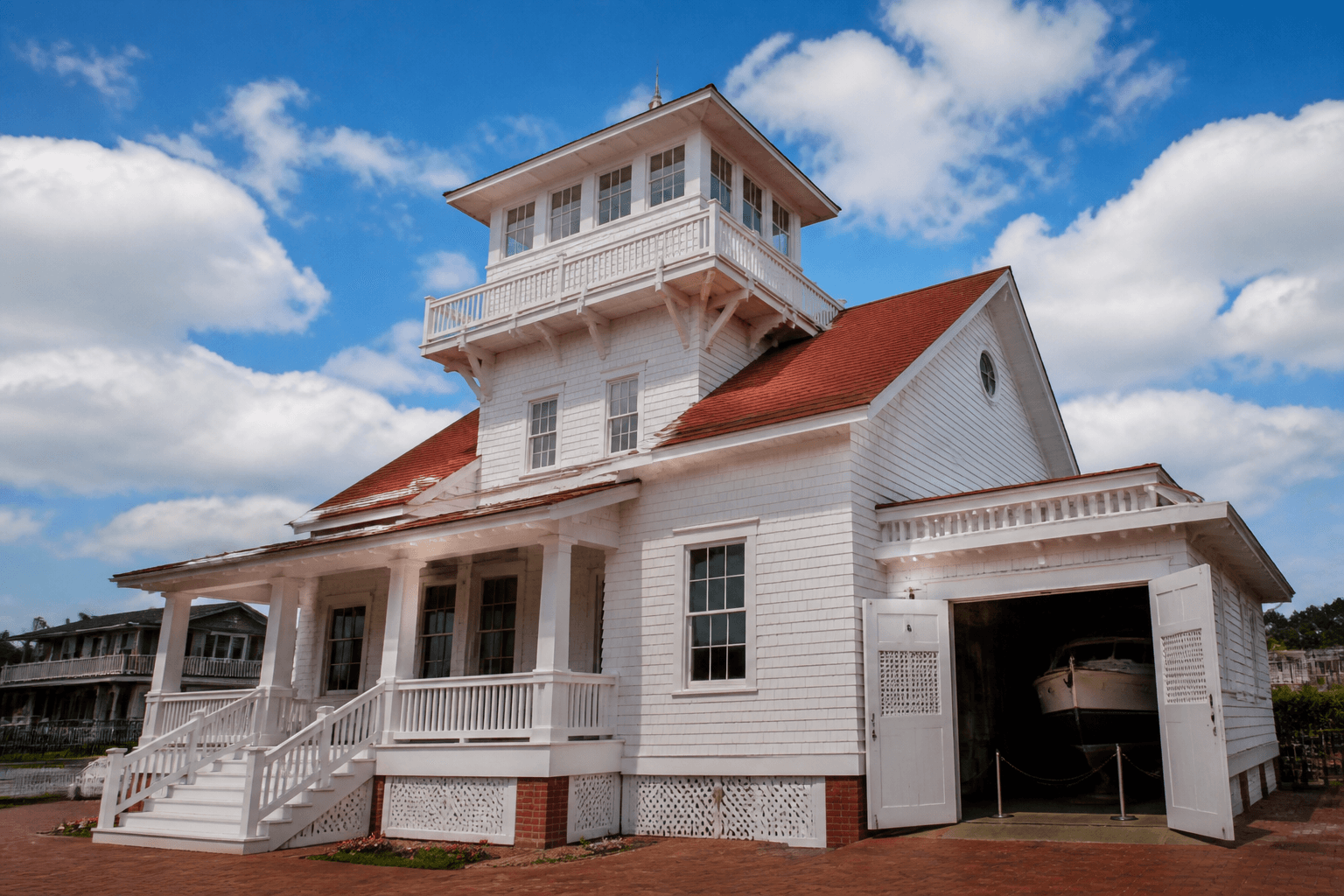
Shipwreck geography made U.S. Life-Saving Service stations part of daily life. A station opened in 1878; the surviving 1891 structure now houses the Ocean City Life-Saving Station Museum at the south end of the boardwalk—one of the best on-site stops if you want artifacts, surfboat imagery, and narrative context in an hour or less.
Boardwalk, amusements, and early beach engineering
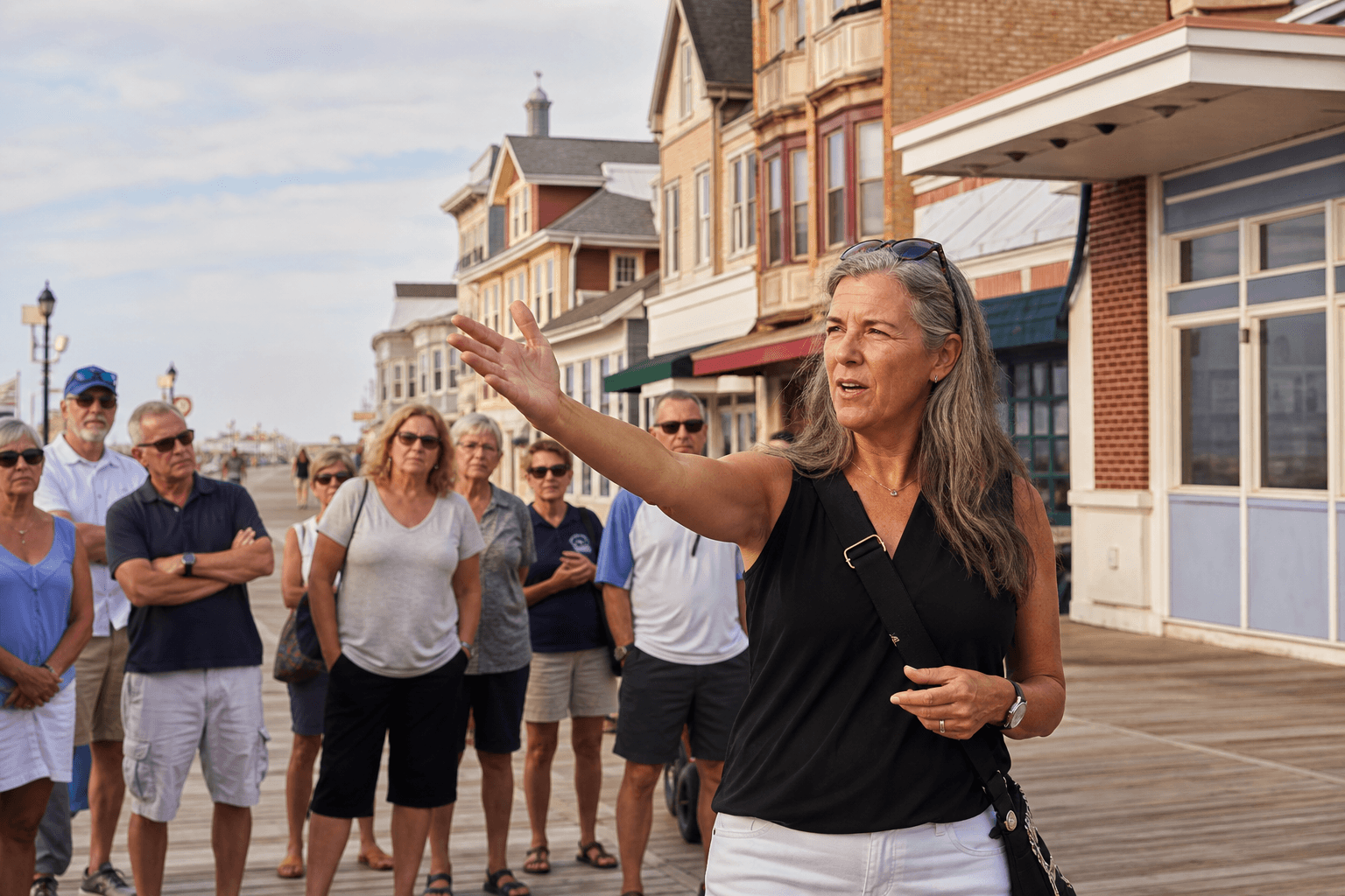
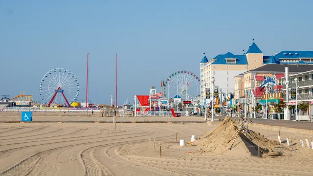
Hoteliers laid the first seasonal boardwalk—originally dubbed “Atlantic Avenue”—around the turn of the century (often dated 1902 in encyclopedic articles, while the Chamber history page cites 1900). The idea was practical: give guests a sand-free stroll, then roll planks away in winter. Trimper’s Rides traces to 1893 as the Windsor Resort before evolving into the Trimper’s brand; its 1912 Herschell–Spillman carousel is a National Carousel Association honoree. Parallel to fun came public safety structure: Mayor William W. McCabe and Coast Guard Capt. William Purnell helped formalize the Ocean City Beach Patrol in 1930 as swimmer counts exploded.
The Great August 1933 hurricane and the accidental inlet
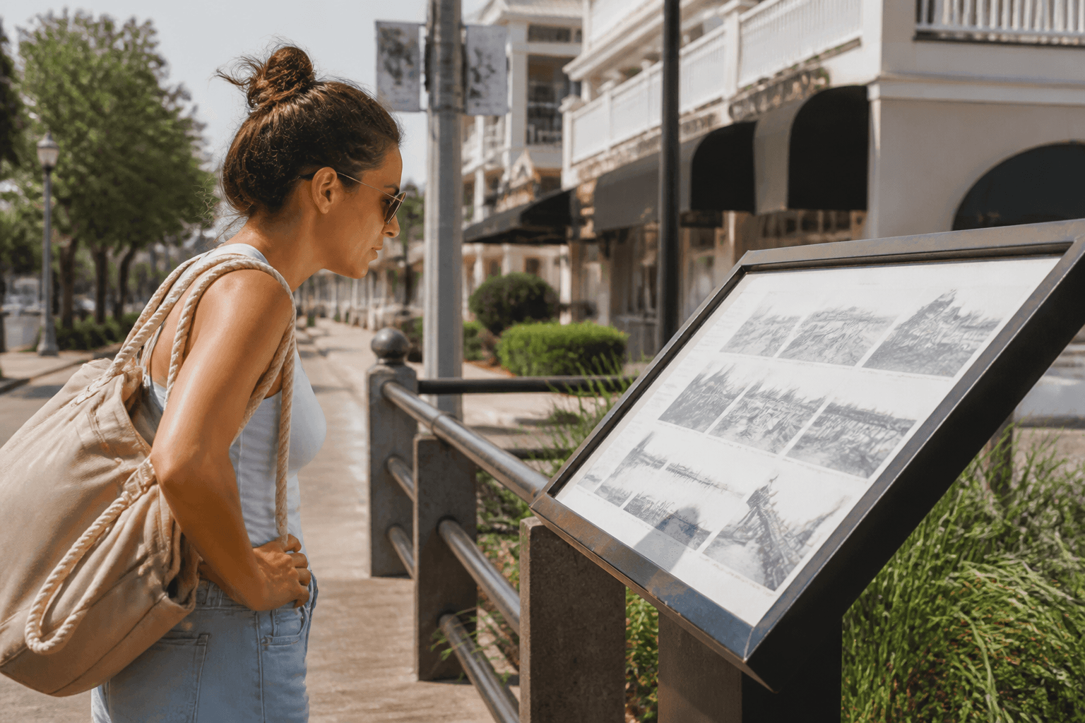
Ocean City’s modern silhouette was carved by weather. A soaked summer stacked water in the back bays until the August 1933 Chesapeake–Potomac hurricane punched an ocean connection—a new Ocean City Inlet—across Fenwick’s former continuous spit, isolating Assateague to the south. Contemporary accounts and a surviving amateur film shot by S. Watts Smyth (donated to the Maryland Center for History and Culture) captured both destruction and the inlet’s raw first hours. A September 1933 follow-on storm reportedly widened the cut from roughly a hundred feet toward five hundred. Town leaders and the U.S. Army Corps of Engineers then armored nature’s work with jetties, stabilizing navigation that local boosters had long sought but could not finance alone. The same storm regime wrecked the railroad trestle, accelerating the automobile era.
Corps dredging in the late 1930s also moved bay fill westward—popular histories credit that work with creating new bay-side avenues such as Chicago and St. Louis Streets atop former marsh, extending buildable lots.
Postwar bridges, condos, and the megaresort era
The Chesapeake Bay Bridge (1952) linked the Eastern Shore to Anne Arundel County and the Baltimore–Washington megalopolis; the Chesapeake Bay Bridge-Tunnel (1964) opened a competing southern funnel from the Virginia capes. Drive-in tourism supercharged motel strips, seafood houses, and eventually thousands of condominium units—encyclopedic summaries cite more than 15,000 by the 1970s boom, while the Chamber page rounds to “more than 10,000” in that decade. Either figure conveys the vertical skyline modern visitors know.
Storms, beach nourishment, and the working dune line
The March 1962 “Ash Wednesday” northeaster flooded streets and shredded boardwalk infrastructure, prompting rebuilds that extended the promenade. Hurricane Gloria (1985) triggered another major boardwalk repair cycle and helped justify hardened seawalls. Hurricane Sandy (2012) flooded and destroyed roughly half the boardwalk before another rebuild. Between storms, beach nourishment—pumping offshore sand ashore—became a standing program to counter longshore drift and westward retreat of the berm, especially after early beach narrowing in the 1980s–1990s.
Recent chapters visitors still feel
High-rise infill, convention-center events, and shoulder-season festivals (Sunfest, Springfest, bike weeks, winter lights) diversified revenue beyond eight summer Saturdays. Sportfishing tournaments—notably marketing around white marlin—keep the inlet packed with camera boats every August. West-of-the-bay growth toward Berlin and Ocean Pines blurred old “island vs mainland” distinctions: today’s “Ocean City trip” often includes Route 50 retail, golf in Worcester County, and Assateague day trips as standard add-ons.
Sources and further reading
Consult multiple institutions; dates sometimes vary by a year between promotional copy and peer-reviewed histories.
- Wikipedia — Ocean City, Maryland (crowd-sourced overview with citations to newspapers and government reports).
- Wikipedia — 1933 Chesapeake–Potomac hurricane.
- Greater Ocean City Chamber of Commerce — History.
- Maryland Center for History and Culture — Ocean City: The Great Hurricane of 1933 (film provenance and preservation context).
- Maryland Center for History and Culture — March 1962 storm.
- Preservation Maryland — Historic Ocean City.
- Secrets of the Eastern Shore — Hurricane of 1933 (narrative journalism).
- DelmarvaNow — 1933 storm silver lining (newspaper perspective).
- National Park Service — Assateague Island history & culture (barrier-island ecology adjacent to the inlet).
- Town of Ocean City, Maryland — official site (ordinances, beach rules, and municipal history pages).
- Ocean City tourism / OC Ocean (visitor services including museum links).
Taste the present layer: seafood, sweets & treats, food & drink. On-the-water planning: fishing, the (.
Ocean City history FAQs
- When did Ocean City become a resort town?
- Most timelines anchor the modern resort to July 4, 1875, when the Atlantic Hotel opened. Paid beach hospitality began earlier: Isaac Coffin’s beachfront guest cottage (1869) is widely cited as the first purpose-built lodging for paying visitors. The town incorporated in 1880.
- What did “The Ladies’ Resort to the Ocean” mean?
- Before intensive development, the barrier spit was marketed under that genteel Victorian-era name—evoking a healthful, supervised seaside retreat rather than today’s high-season boardwalk energy. It reflects how promoters framed the beach in the 19th century.
- How did the 1933 hurricane change Ocean City physically?
- The August 1933 Chesapeake–Potomac hurricane (and the bay-side flooding that accompanied a wet summer) cut a new inlet through the barrier island, separating Ocean City from what became Assateague Island to the south. A following September storm reportedly widened the breach. The U.S. Army Corps of Engineers later hardened the inlet with jetties—turning a disaster into permanent harbor access.
- What happened to the railroad that once served Ocean City?
- Passenger and freight rail reached toward the resort from the 1870s–1880s via lines that connected Berlin and the Baltimore, Chesapeake & Atlantic network across Sinepuxent Bay. The 1933 hurricane destroyed the bay crossing; afterward, autos and bridges—not trains—carried most visitors.
- When was the Ocean City Boardwalk first built?
- Sources differ slightly: the Greater Ocean City Chamber of Commerce history page cites 1900 for a seasonal boardwalk; Wikipedia’s Ocean City article dates the first walk (originally “Atlantic Avenue”) to 1902. Either way, it began as a practical seasonal promenade for hotel guests, not the long concrete-backed promenade of later decades.
- What is Trimper’s Rides and why is it historically notable?
- Trimper’s is a landmark boardwalk amusement operation whose roots reach back to the 1890s. It includes one of the country’s oldest operating carousels (Herschell–Spillman, 1912)—useful context when you wonder why Ocean City’s boardwalk feels like a living museum as well as a modern arcade strip.
- How did the Chesapeake Bay Bridge and Bridge-Tunnel reshape visitation?
- The Bay Bridge opened in 1952, linking the Eastern Shore to Annapolis and the Baltimore–Washington corridor. The Chesapeake Bay Bridge-Tunnel (1964) added a long southern approach from Virginia Beach/Norfolk. Together they slashed drive times for millions of potential weekenders and accelerated postwar condo and motel construction.
- What was the March 1962 “Ash Wednesday” storm?
- A prolonged northeaster in March 1962 devastated Mid-Atlantic beaches; Ocean City’s boardwalk was damaged badly enough that later rebuilds extended its length. The Maryland Center for History and Culture and other archives treat it as a companion cautionary tale to the 1933 hurricane.
- Where can I watch or read primary material on the 1933 hurricane?
- The Maryland Center for History and Culture holds amateur film of the 1933 storm and inlet formation (S. Watts Smyth footage; grant-funded preservation). Contact their special collections for access rules. Local news outlets and Delmarva papers also revisit the anniversary with oral-history color.
- Who were the Indigenous people of this shoreline?
- Standard reference works summarize the pre-colonial coast as home to Algonquian-speaking peoples—including ancestors linked to Nanticoke and Assateague communities—who fished, gathered, and moved along Delmarva barrier ecosystems. Modern tribal governments and historians should be treated as the authorities on specific nations and treaties; this page only sketches regional context.
- Does OCEANCITY.MD replace libraries, the Town of Ocean City, or the Coast Guard for facts?
- No. This article synthesizes widely published timelines for trip context. Deeds, incorporation records, lifesaving logs, and engineering drawings live in archives and government repositories. When your project is legal, genealogical, or academic, cite those institutions directly.
- How does knowing history help a 2026 beach week?
- Storm history explains nourishment equipment, dune lines, and why nor’easters still flood low streets. Resort history explains summer staffing, event weekends, and why the south end feels different from midtown high-rises. Pair this page with travel tips, climate notes, and the events calendar—not as a substitute for lifeguard flags or NWS advisories.

Beach Blog on Ocean City history
Trip reads written for this hub—pacing and advice, not a second directory.